Author(s): Ghanimat Azhdari, Ali Razmkhah, Nina Aminzadeh Goharrizi, Maede Salimi, Ahmad Beiranvand, Nahid Naghizadeh, and Soheil Hosseinzadeh
Iran is a vast country located in the arid belt of southwest Asia; 85 per cent of its land area comprises arid and semi-arid regions harbouring rangelands, high to low-density forests and deserts. Thousands of territories of life in Iran are formed by various ethnic groups – including Arab, Baluch, Gilaki, Kurd, Lur, Persian, Turk and Turkman – with significant diversity in culture, language, traditions and customary systems of nature conservation. Historically, both nomadic peoples and non-nomadic communities have had an intertwined relationship with nature through their complex social-ecological governance systems. This relationship with nature is based on social organisation, identity, collective production and adaptation of the governance and management systems of communities.
The territories of life of Indigenous nomadic peoples of Iran cover almost 59 per cent of the country, including 34 million hectares of rangelands and 660,000 hectares of agricultural land (irrigated and rainfed). Nomadic peoples established and evolved an adaptive dynamic system of seasonal migrations approximately 12,000 years ago in Iran. According to the latest statistics, Iranian nomads form 104 tribes and 554 independent tribes,[1] consisting of 246,000 families with a population of 1,108,000, or 1.32 per cent of the country’s population. In addition, nomads hold 28 per cent of light livestock and 4 per cent of heavy livestock of the country, and produce 20 per cent of red meat and livestock products, supplying 9 million livestock to the market annually. With the production of 35 per cent of the country’s handicrafts, nomads are among the most productive parts of society.[2]
Iranian non-nomadic communities have also led to the formation of diverse territories of life alongside other agricultural heritage systems. This diversity is evidenced in historical background, cultural, climatic and environmental features.
In these territories of life, a wide variety of governance systems exist for managing and conserving nature and biodiversity. These systems provide exceptional and valuable experiences that help address climate change and environmental challenges and they also feature technologies that provide a variety of services on a sustainable basis.
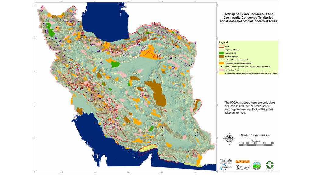
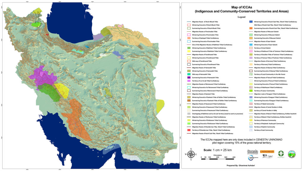
Map of ICCAs in Iran (including only a pilot region of about 15% of the national territory). Credits: CENESTA/UNINOMAD
Biocultural governance systems of territories of life in Iran
The unique biocultural governance systems of the Indigenous peoples and local communities of Iran include a set of norms, ethics, values and cultures that they have learned and created throughout history, influenced by climatic and environmental diversity. The systems of governance have contributed to a range of diverse ecosystems such as wetlands, forests, pastures, grasslands, deserts, marine and coastal environments. Despite all differences and local variations, the common issue among Indigenous peoples and local communities of Iran is their knowledge and biologically- and culturally-based governance systems for the conservation of their territories of life.
Indigenous technologies and sustainable methods of these systems adapted to harsh environmental and climatic conditions on a local scale, directly and indirectly, affect the conservation and sustainable use of water, soil and biodiversity. Underground water management systems (Qanats), seasonal migration, multi-layered cultivation system and Qorukh[3] (protection, prohibition) are examples of resource management practices in territories of life.
Traditional farming in Qasr-e-Qand, Balouch peoples, Chabahar. Photo: CENESTA
Multi-layered cultivation system in Qasr-e-qand, territory of Balouch Peoples, Chabahar. Photo: Soheil Hoaseinzadeh
Multi-layered cultivation system in Qasr-e-qand, territory of Balouch Peoples, Chabahar. Photo: Soheil Hoaseinzadeh
Traditional farming in Qasr-e-Qand, Balouch peoples, Chabahar. Photo: CENESTA
Qorukh in territories of Lor nomadic tribes. Photo: CENESTA
Rangeland Qorukh in Bakhtiari territories of life. Photo: CENESTA
An Uba (smallest social unit in Shahsavan tribal structure) in their summering ground. Photo: CENESTA
Bactrian Camel (two-humped) in Shahsevan territories (Northwest of Iran). Photo: Fatma Zolfaghari
Examples of territories of life in Iran
Marine ecosystems
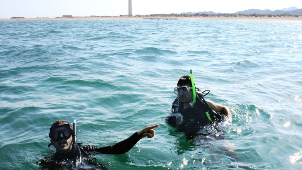
Iran borders three major marine bodies: the Caspian Sea in the north, and the Persian Gulf and the Oman Sea in the south. Traditional fishing methods have been practised on both coasts for thousands of years and fisheries were managed through customary rights and regulations. For example, the Damgostar or Parreh[4] fishing method is practised by local fishermen in the north, allowing them to benefit from rich fish resources of the Caspian Sea, namely, sturgeon. The nets used ensure only adult fish are caught and juvenile fish can continue to grow. Similarly, in the south, small traditional fisheries (e.g., Moshta) that allow for release of dolphins and turtles are practised by villagers of northern Qeshm Island,[5] although trawl fishing by international and national industrial fishing vessels has been promoted by the Fisheries Organization of Iran (Sheelat). However, fisheries have been in decline since territories of life have been undermined by various policies. For example, traditional fishing methods are prohibited under the pretext that they endanger other aquatic species, certificates are not readily issued for traditional boats and dinghies of local communities, and the aquaculture industry is a competing development.
Sustainable use of mangrove forest in Qeshm Island. Photo: Ramin Rohani
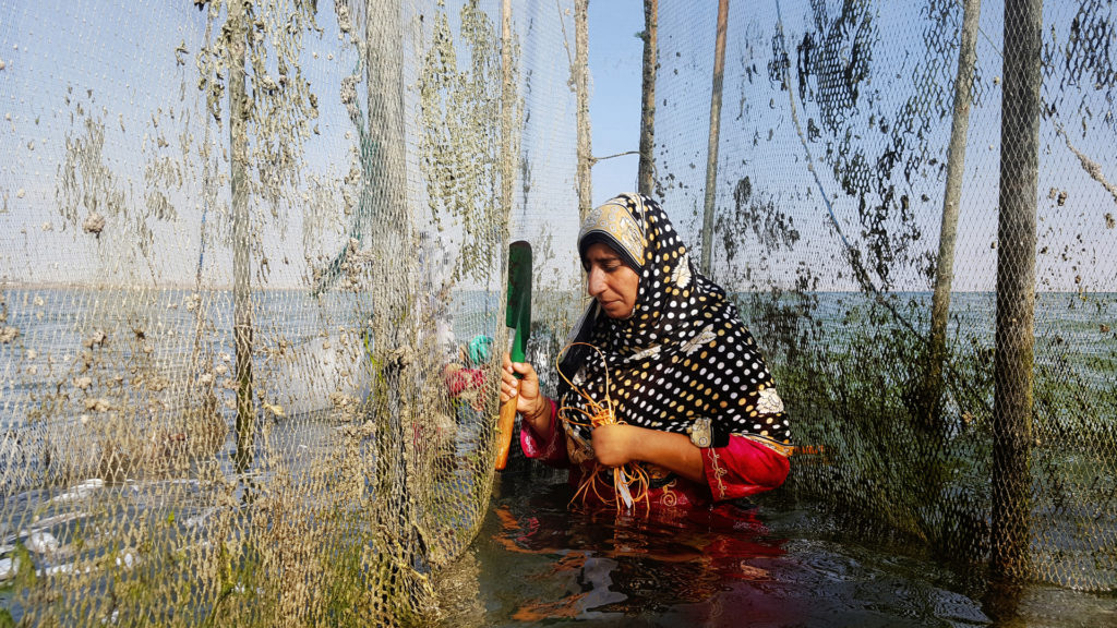
Traditional fishing of Qeshm Island Indigenous women. Photo: Fatma Zolfaghari
Traditional fishing of Balouch peoples, Chabahar. Photo: CENESTA
Traditional fishing of Balouch peoples, Chabahar. Photo: CENESTA
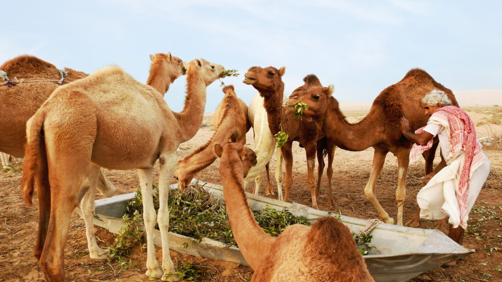
Dromedary camel in Qeshm Island (south of Iran). Photo: Fatma Zolfaghari
Desert ecosystems
Most of Iran is covered by deserts, thus historically, people have learned how to cope with water scarcity. One of the ingenious ways of collecting and managing water resources was formed around Qanat, a complex tunnel system that extracts groundwater from mountain basins. Qanats are still counted as one of the main ways of procuring water for irrigation and agricultural development in the internal plateau of Iran. In most cases, however, Qanats are more than just a way of using groundwater. They represent a unique and integrative system illustrating the use of Indigenous knowledge and wisdom in the sustainable management of land, water and agricultural biodiversity.
Several issues are affecting these water management systems in the desert. Construction, maintenance and management of Qanats require strong collaborative work. The lowering of water tables, partially caused by an increase in the number of wells, has led to the decline of many Qanats. There are now few skilled workers (Moghanees) and the former wealth of knowledge on water management in dry regions of Iran is fast disappearing.
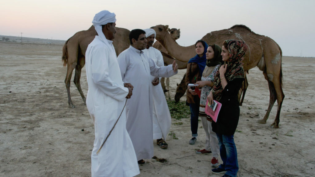
Some of the most important ICCAs in Iran belong to the tribal communities. There are many different tribes, including Qashqai, Shahsavan, Bakhtiari and Balouch,[6] spread all over Iran. Tribal communities are highly organised in terms of social structure. Customary territories of tribal communities consist of summer and winter territories as well as migratory corridors. In the past, decisions about the timing of migration were taken by the elders who were appointed based on merit and trust. The degradation of rangelands is caused by the loss of customary rights, migration routes being cut by so-called development projects, and the erosion of social structures since migration starts earlier to get better access to resources.
Gathering of Bakhtiari tribes, territories of Bakhtiari, Khouzestan. Photo: CENESTA
Seasonal migration of Qashqai, Fars. Photo: CENESTA
Forest ecosystems
There are at least three forest types in Iran: Hyrcanian (Caspian) forests in the north, oak forests of the Zagros mountains, and mangrove forests along the southern coasts. Local communities living in the forests have always had the knowledge to manage them and their resources. Talesh tribes have also been practising their customary rights in managing the Caspian forests. Despite these efforts, forest social-ecological systems are in rapid decline due to population increase, pressure on forest dwellers to abandon their villages, lack of grazing permits and economic poverty.
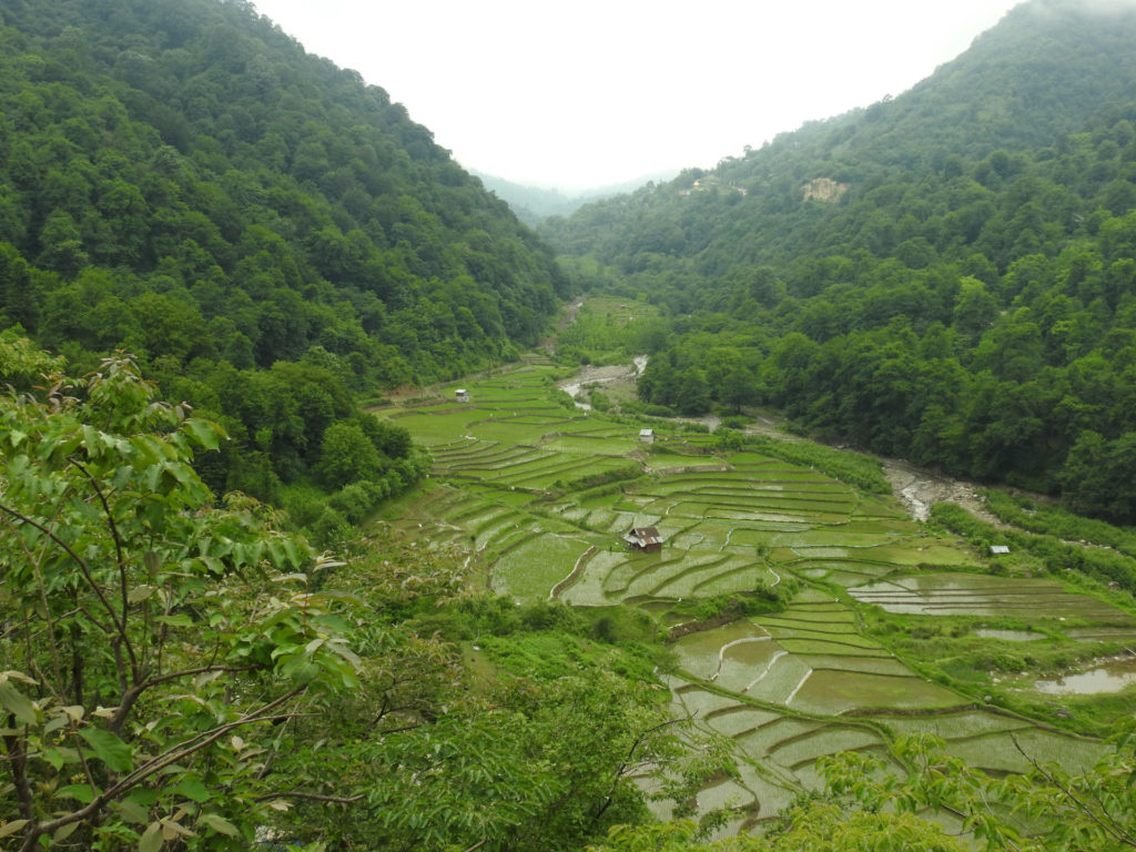
Rice cultivation along the forest and river provide soil protection and efficient water utilization in Mazindran Province. Photo: Soheil Hoaseinzadeh
Wetland ecosystems
Wetlands have always attracted people to this source of water for agriculture, fisheries, tourism and other services. Many of Iran’s territories of life are formed in and around these wetlands and their resources. Communities have developed ingenious ways of sustaining wetland resources because of their importance in supporting livelihoods.
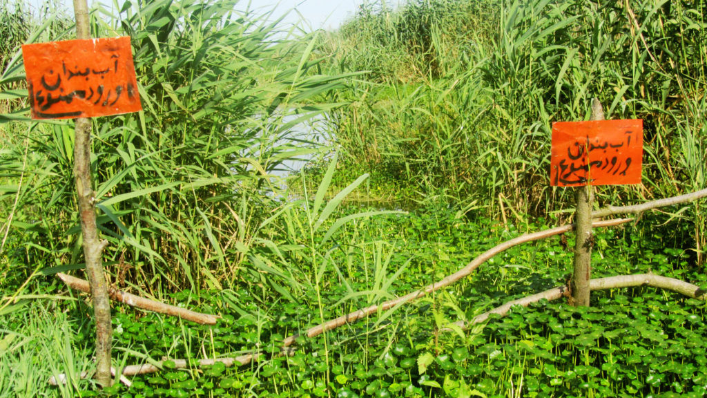
One example of ingenuity comes from the Anzali wetland (measuring approximately 193 km2), a Ramsar site on the southern coast of the Caspian Sea. The system of customary management practiced among the communities surrounding the wetland is known as Abbandan-dari. An abbandan is a type of shallow, man-made reservoir found in the southern Caspian lowlands and used both for aquaculture and to supply water for rice farming. A specific form of abbandan occurs within the Anzali wetland, where they range in size from 10 to 100 hectares. The customary abbandan-dari system is practised by a group of local people referred to as abbandan-dar. Since 1971, however, abbandan-dari practices have been undertaken in a new way under the supervision of the Department of Environment. Areas are rented to local communities for a period of six months (6 September to 6 March, to cover the fishing and hunting seasons), and conservation conditions are built into the rent agreements.
Kushk-e Zar wetland, Qashqai territories of life, Fars province. Photo: CENESTA
Ab-bandan. Photo: CENESTA
Mountain ecosystems
Iran’s two mountain ranges, Zagros and Alborz, have cold and dry climates that created unique territories of extraordinary beauty, especially in the west and northwest of Iran. Geographical isolation and limited natural resources, especially the lack of arable lands, led to the development of clever management of soil and water resources based on a specific form of social organisation. Using local materials, Indigenous peoples of the region have learned to make best use of the scarce available resources, by building terraces for gardens and enriching them with good soil for agriculture from other parts of the territory such as riverbanks.
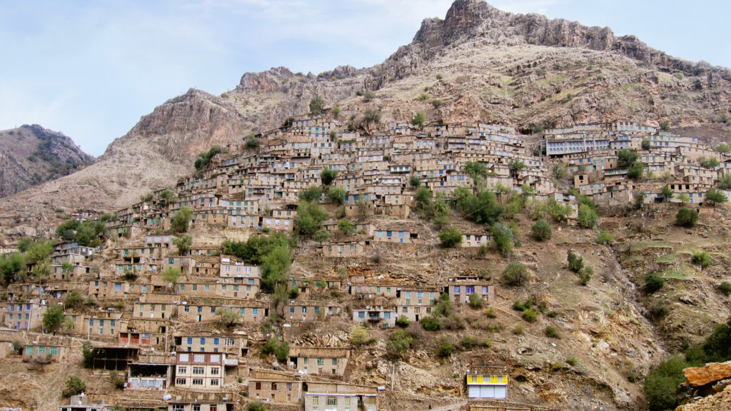
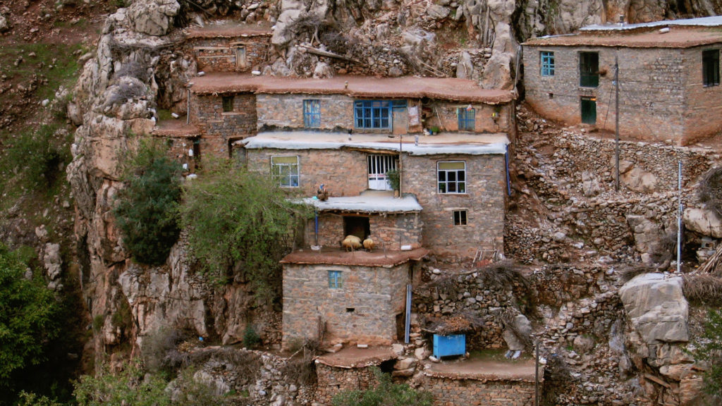
A remarkable example is Hawraman, a mountainous region extended through western Iran (Kurdistan and Kermanshah provinces) and eastern Iraq. The climate and environmental conditions of Hawraman have caused the people of this region to live in different parts of their territory in different seasons of the year. Each village has one or more summering settlements called “Ha’var”, most of which are located in flat terraces or mountain ranges around the springs.
Hawraman. Photo: CENESTA
Hawraman. Photo: CENESTA
National policy and legal context of territories of life in Iran
Despite the long history of nature conservation by Indigenous peoples and local communities, the establishment of the centralised modern nation-state and the influence of Western concepts in protection and exploitation of nature have jeopardised local capacities in caring for nature. Since 1921, almost all Iranian governments have attempted to replace the customary institutions of natural resource management and livelihood systems of Indigenous peoples and local communities. This was further entrenched beginning in 1963 with the nationalisation of natural resources, and later in the 1970s with land reform policies for agricultural modernisation. Agricultural policies after the 1979 revolution again led to widespread destruction of natural resources and had severe negative effects on the culture, traditions, and biocultural systems of Indigenous peoples and local communities. The disintegration of territories of life worsened further due to protected area laws and regulations that expelled Indigenous nomadic peoples from these areas. Such top-down policies and laws have severely damaged both the social and ecological aspects of the territories of Indigenous peoples and local communities and weakened customary governance systems.
In addition to policy changes, large-scale infrastructure and industrial developments have been increasing noticeably in Iran and impose new threats for territories and culture of Indigenous peoples and local communities. Some examples include: (1) the areas of Makoran, in the core of Balouch territories, which are occupied by a large industrial development called Chabahar Free Commercial Zone; (2) the recent development of the petrochemical industry along the coast; (3) the dams in the Bakhtiari’s territories of life, which submerged many settlements and led to forced migration; and (4) a land change programme (pasture to farm) for Shahsavan’s territories of life related to the Khoda-Afarindam.
Overlap of ICCAs and official protected areas. Map: CENESTA and UNINOMAD
In the face of threats and challenges over the past decades, the resilience of Indigenous peoples and local communities and their deep sense of belonging to their territories and their efforts to preserve spiritual, economic, socio-cultural and environmental values of their territories of life is remarkable. Fortunately, there is an increased awareness about the territories of life of Indigenous peoples and local communities and their values for nature conservation due to valuable actions by civil society organisations and grassroots movements as well as local discourses regarding newer approaches to development.
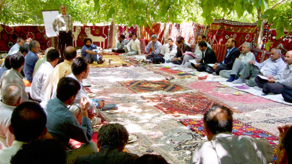
One example of a strong, resilient local organisation is Iran’s Centre for Sustainable Development and Environment (Cenesta), which has been working on re-empowering communities and restoring tenure rights on their territories of life for over thirty years. Cenesta’s priority has been to help communities re-establish their customary governance institutions and rebuild their resilience in the face of social, political and environmental changes. Engaging in a participatory process with Indigenous peoples and local communities through traditional councils of community elders and their associated community investment funds (sanduqs) is the primary means of implementation of Cenesta’s work.
Governmental assessment. Photo: CENESTA
Elders of Bakhtiari during participatory mapping workshop. Photo: Ramin Rohani
Ecological assessment. Photo: CENESTA
Ecological assessment. Photo: CENESTA
Field visits and holding participatory meetings with members, elders and trustees of the community. Photo: CENESTA
Field visits and holding participatory meetings with members, elders and trustees of the community. Photo: CENESTA
Field visits and holding participatory meetings with members, elders and trustees of the community. Photo: CENESTA
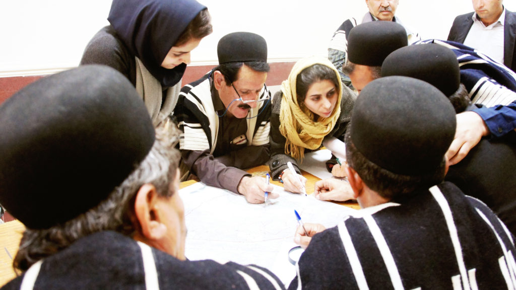
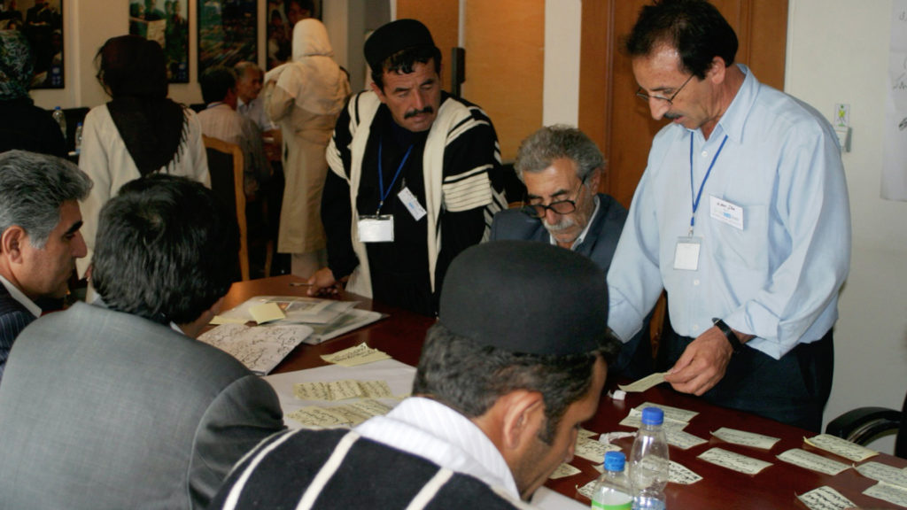
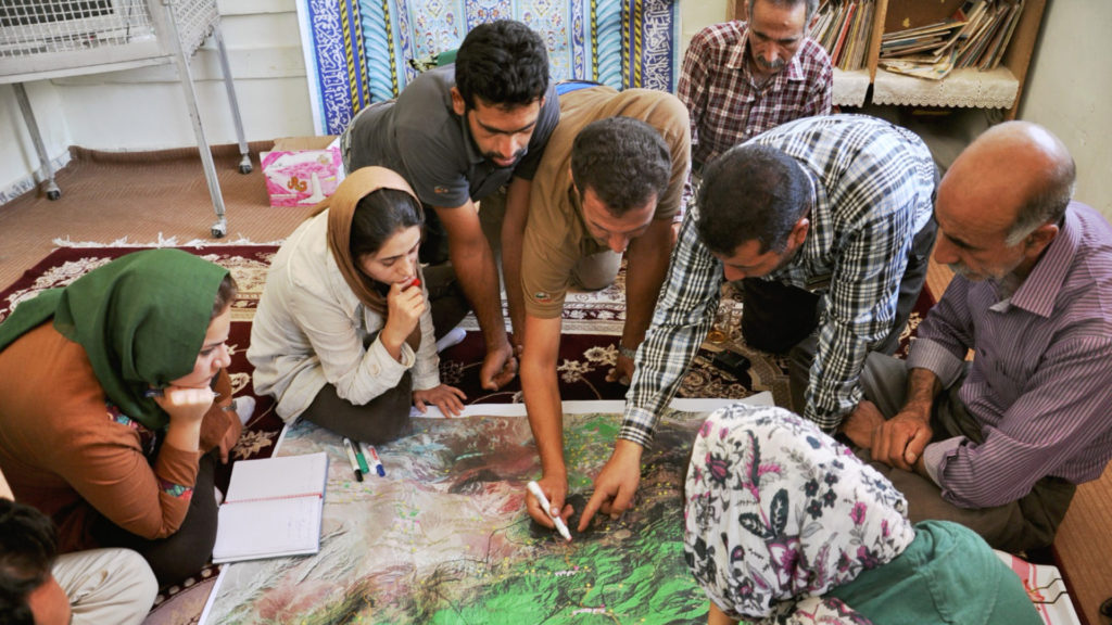
One of the most important programs of Cenesta aims for the appropriate recognition of territories of life through their documentation and registration. This effort involves field visits and holding participatory meetings with members, elders and trustees of the community. It also requires determining the scope of territories of life through participatory mapping,[7] as well as preparing and compiling assessment reports in the fields of ecology, governance and livelihoods. These reports and participatory maps are used in litigation processes and negotiations with governmental authorities. Since 2003, Cenesta has been facilitating the organisation and registration of various councils of tribal elders and their associated community investment funds (sanduqs). These efforts culminated in 2010 in the creation of the Union of Indigenous Nomadic Tribes of Iran (UniNomad), a national federation whose members are registered tribal confederacies and independent tribes of Iran.
As a result of Cenesta’s many efforts, improvements have been made in recent years in policies of natural resource management and environmental conservation. A participatory approach has been adopted in some of the relevant policies, which could have positive impacts on the status of territories of life in Iran. The most transformative action has been represented in Article 38 of the “Law on the Sixth Five-Year Economic, Cultural, and Social Development Plan for 1396-1400 (2016 – 2021) (the Sixth Development Plan)”, specifically in paragraphs L, S, and T.
According to this article: “The government is obliged to take the following measures to protect the environment [emphasis added]:
L – Improving the protection of forests, rangelands and national and government lands and four environmental protected areas[8]with the participation of local communities;
S – Preparing, compiling and implementing an action plan to protect and manage the four environmental areas and endangered species of the country’s wildlife through using voluntary and participatory capacities of natural and legal persons with priority given to local communities and NGOs by the Department of Environment;
T – Revision of the scope of the four environmental protected areas, as well as the new definition and division of the areas according to the new divisions of the International Union for Conservation of Nature (IUCN) by the Department of Environment.”
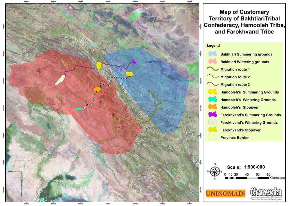
Customary territory of the Bakhtiari tribal confederacy, Hamooleh Tribe and Farokhvand Tribe. Map: CENESTA and UNINOMAD
Determining the scope of territories of life through participatory mapping. Photo: CENESTA
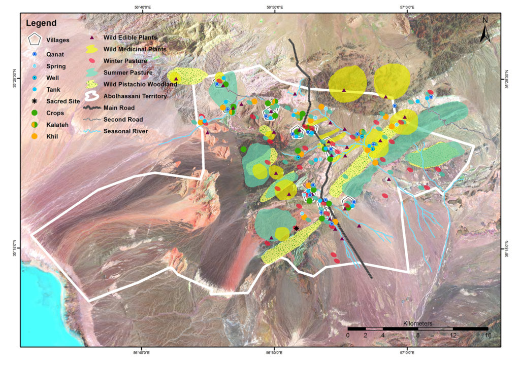
Territories of life of the Abolhasani tribal confederacy. Map: CENESTA and UNINOMAD
Determining the scope of territories of life through participatory mapping. Photo: CENESTA
Recommendations
There are several recommendations that come from Iran’s experience with territories of life:
Indigenous peoples and local communities require appropriate recognition of their customary rights to their territories, their Indigenous and local knowledge, skills, institutions and rules for their governance and management;
The governing institutions of Indigenous peoples and local communities need active participation in policy- and decision-making processes related to their territories of life and natural resources as key rights-holders;
Participatory planning and implementation of programmes should improve, strengthen and revitalise the relational structures between Indigenous peoples and local communities and nature within the territories of life and enhance the sense of community ownership of territories;
The intellectual property rights of Indigenous peoples and local communities and their collective governance and knowledge systems should be respected and recognised;
Efforts should be made to review and reverse inappropriate policies and programmes for natural resource management such as nationalisation of natural resources as well as top-down policies and programmes;
The legally established rights on the protection of the migration routes of nomadic tribes as part of their territories of life should be respected, protected and fulfilled, especially in light of the absolute legal prohibition for any transfer and change of their use; and
Participatory conservation of national plant and animal genetic resources should be promoted and based on the combination of Indigenous knowledge and modern science with the active participation of Indigenous peoples and local communities in their territories of life (in situ conservation).
[1] Including, among others: Qashqai tribal confederacy, Bakhtiari tribal confederacy, Lor and Lak tribes, Shahsevan tribal confederacy, Balouch peoples and central desert periphery tribes such as Sangsari, Abolhassani, Toroud, Abarsej, etc.
[2] Summary of the results of the basic statistics of the nomadic population of the country, Statistics Centre of Iran, 2020.
[3]Qorukh (in Turkish, qoroq in Persian) is a strictly enforced land use limitation system due to needs such as seasonal and periodic restoration of rangelands, forests, wetlands, wildlife and fishing grounds; special needs of certain livestock species (e.g., lactating or young livestock, endangered wildlife, draft animals) or adjustments in range management due to drought periods, migration and transhumance routes.
[4] Fishing method Parreh or damgostar is one of the oldest methods of catching bony fish, including whitefish, on the southern shore of the Caspian Sea (Gilan and Mazandaran provinces). In this method, usually a 1000-meter long and 7- to 10-meter high net is extended in a U-shape by a large wooden boat in the sea, and the end of the net returns to the shore at a distance of about one hundred meters from the starting point. The diameter of the fin nets is large enough (between 30 and 40 mm) to catch only adult fish and is therefore very effective in conserving aquatic stocks. After a while, the net is pulled into the shore from the end by the force of a tractor winch and is collected. As a result, the fish trapped inside the net are gradually directed to the shore and collected by fishermen. In previous times, fishing was carried out by fishermen with the help of animals, and fishermen created a special cohesion and passion by reciting local poems.
[5]Moshta is a traditional method of fishing in the Hormozgan province in southern Iran, which is done using the tide. In this method, sticks are placed on the shore and a fence is created using the fishing net; when the water rises, the fish enter it and when the water goes down, they are caught by the owners of Moshta. In this method, a lot of attention is paid to releasing and not trapping other aquatic animals such as dolphins and turtles.
[6] See territory of life Chahdegal, Iran, in this report.
[7] In participatory mapping, people gather around and participate in making a map by sharing their knowledge and spatial vision. This is an opportunity for nomadic pastoralists, especially since many of them cannot read or write and had never used paper maps. Through participatory mapping (and PGIS in further steps) communities will be able to transfer their knowledge of the landscape and ecosystems to paper maps. After creating paper maps with a facilitator and the people in the communities, she/he works to move on to developing maps using computer software.
[8] Iran’s protected area system uses only four categories: 1) National park: relatively vast natural areas having specific characteristics and national significance from the geological, ecological and bio-geographical points of view that are selected with the purpose of protection and improvement of the population of animal species and vegetation sites. National parks are suitable places for educational and research activities as well as for ecotourism. 2) National natural monument: relatively small, unique, exceptional, unconventional and irreplaceable phenomena having significance from a protection, scientific, historic or natural point of view. 3) Wildlife refuge: representative wildlife habitats selected with the purpose of preserving the population of animal species and improving their level of quality. These areas are appropriate places for educational and research activities. Compatible use and controlled tourism are allowed in refuges. 4) Conservation area: relatively vast areas of high protection significance are selected with the purpose of preserving and restoring plant sites and animal habitats. Controlled tourism and economic uses under the management plan are allowed.


 Traditional farming in Qasr-e-Qand, Balouch peoples, Chabahar. Photo: CENESTA
 Multi-layered cultivation system in Qasr-e-qand, territory of Balouch Peoples, Chabahar. Photo: Soheil Hoaseinzadeh
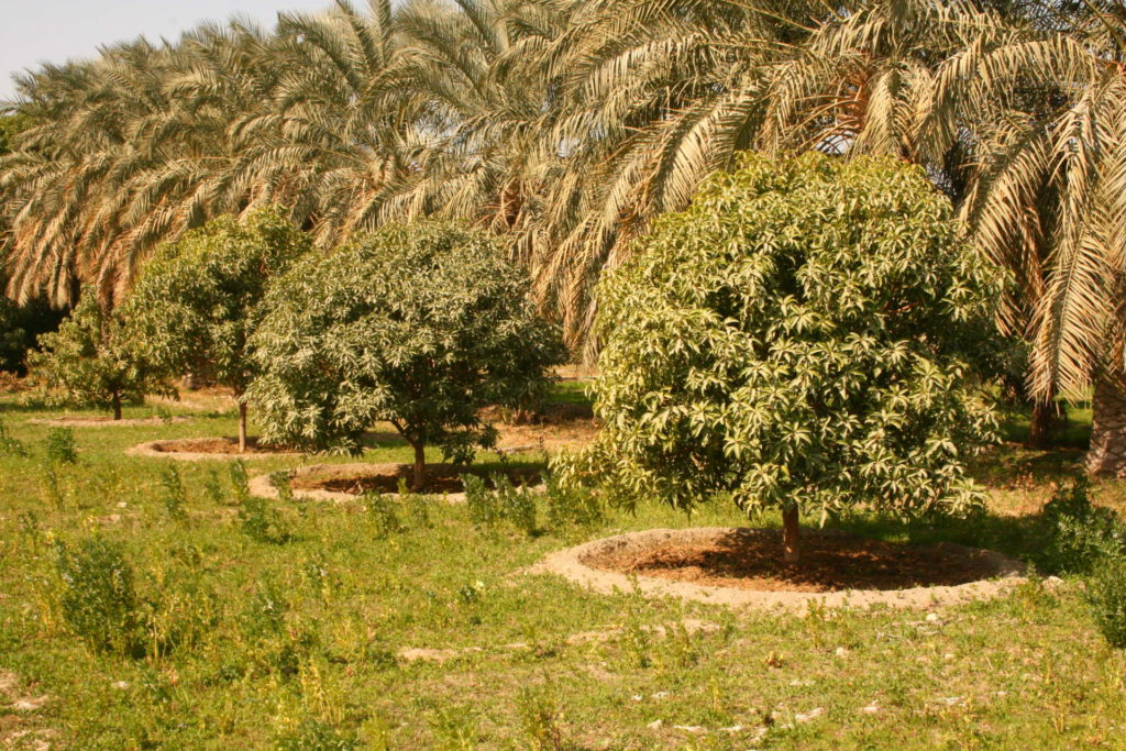 Multi-layered cultivation system in Qasr-e-qand, territory of Balouch Peoples, Chabahar. Photo: Soheil Hoaseinzadeh
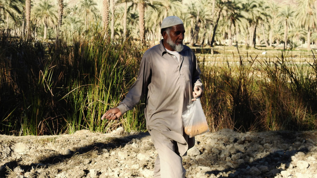 Traditional farming in Qasr-e-Qand, Balouch peoples, Chabahar. Photo: CENESTA
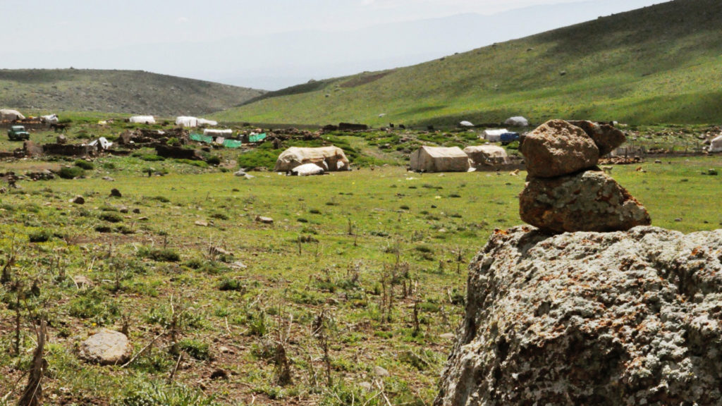 Qorukh in territories of Lor nomadic tribes. Photo: CENESTA
 Rangeland Qorukh in Bakhtiari territories of life. Photo: CENESTA
 An Uba (smallest social unit in Shahsavan tribal structure) in their summering ground. Photo: CENESTA
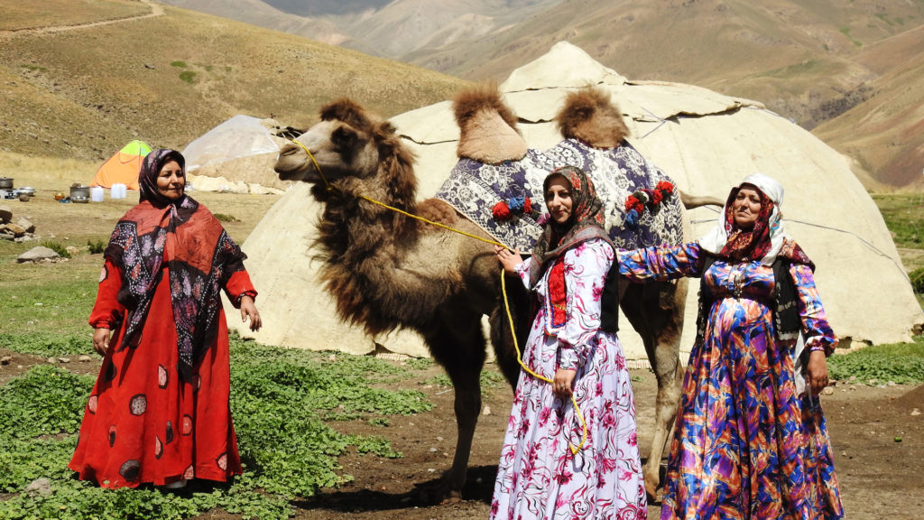 Bactrian Camel (two-humped) in Shahsevan territories (Northwest of Iran). Photo: Fatma Zolfaghari